A brief weekend update as rain begins to fall in parts of the state. Below is expected precipitation through Tuesday. 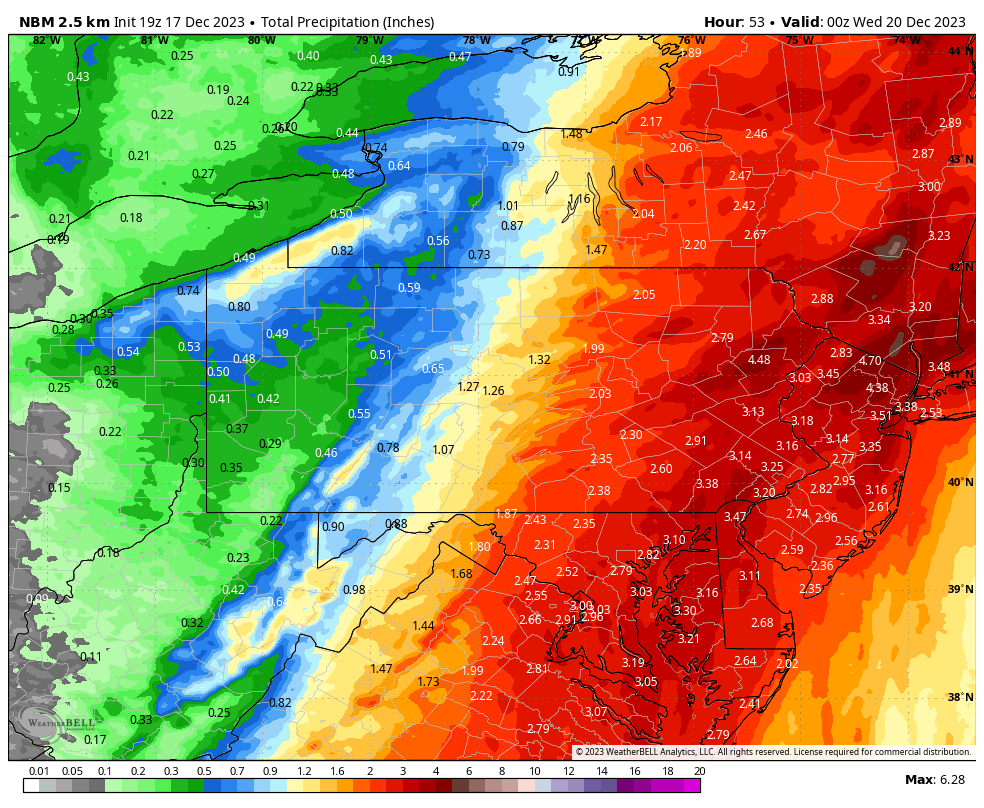 Now onto snowfall. Here is the model blend, or average snowfall output among models.
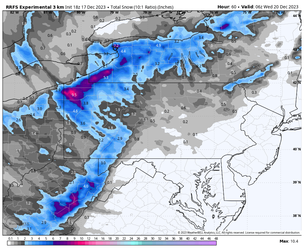
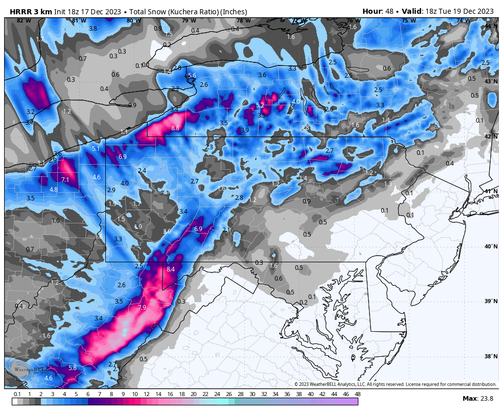
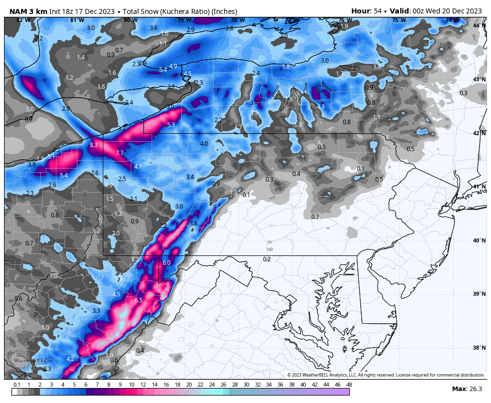
 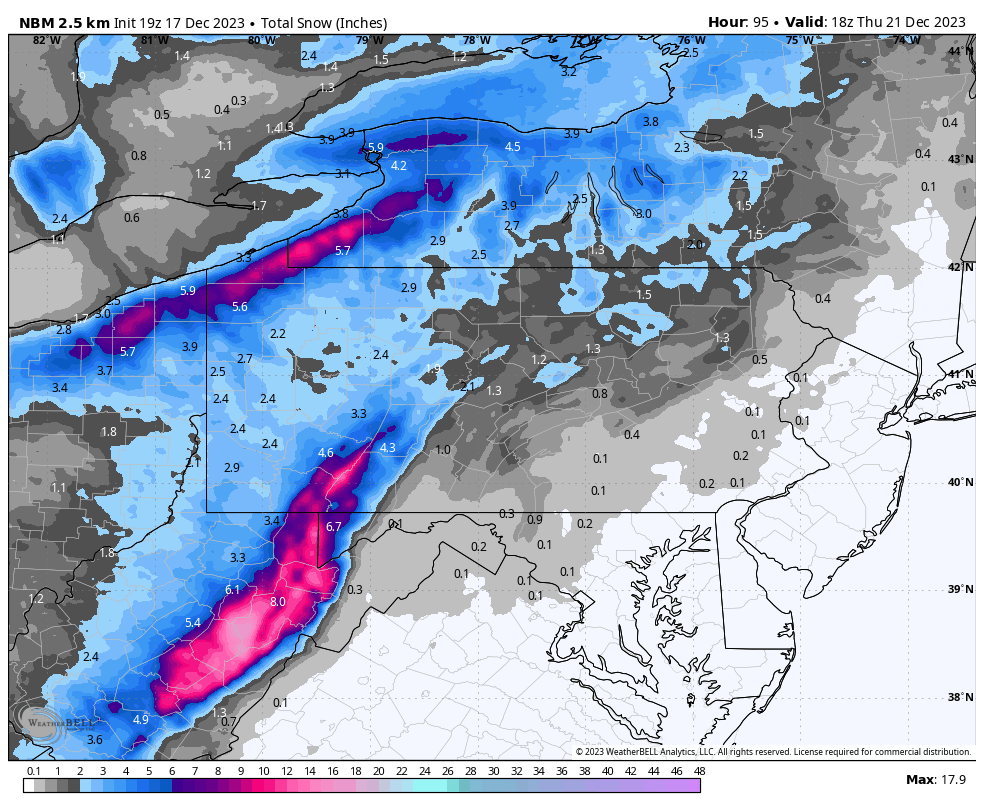 Generally above 6” in the lake effect belts of NWPA about 10 miles away from the shore, and in western facing slopes of the Laurel Highlands. Now into the other short range guidance, which isn’t as generous in the Pittsburgh area.
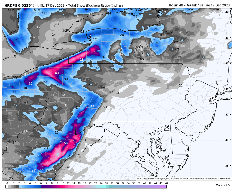
 Winter weather alerts have been issued in much of Western Pennsylvania ahead of this, and lake effect is always localized.
Subscribers Only
Brief Model Update on Backend Snow & Precipitation Totals Now – Tuesday
Written on 12/18/2023
Joshua Adams
Remove Ads & View Updates
Free 1 Week Trial to view updates & remove ads!